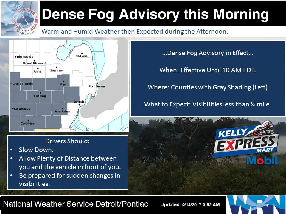
The National Weather Service in Grand Rapids has issued a Dense Fog Advisory…which is in effect until 9 AM EDT this morning.
Areas of dense fog will lift this morning and high pressure will bring fair weather through the end of the week. The next chance for rain will be on Sunday afternoon as a cold front approaches.
Today: Partly sunny. Areas of fog until midday. Highs in the upper 70s. Light winds.
Tonight: Mostly clear. Patchy fog overnight. Lows in the mid 50s. Light winds.
Friday: Mostly sunny. Highs around 80. Light winds becoming south 5 to 10 mph in the afternoon.
Friday Night: Mostly clear. Lows in the upper 50s. Southeast winds around 5 mph.
Saturday: Sunny. Highs in the lower 80s. South winds around 5 mph.
Saturday Night: Mostly clear. Lows around 60.
Sunday: Mostly sunny until midday then becoming partly sunny. Highs in the lower 80s.
Yesterday’s high was 72 at 4:39 PM. The low was 53 at 1:25 AM.
Average temperature for today is 74. The record high is 90 set in 1976, record low is 33 set in 1975.
0.00 inches of of precipitation yesterday. Total precipitation for the month: 0.56 inches.
Sunrise today at 7:17 AM EDT. Sunset at 7:49 PM EDT.