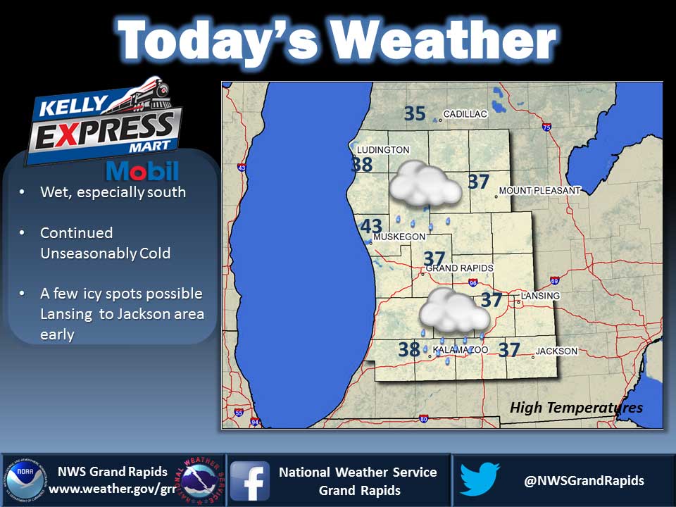
A weak area of low pressure will track through the region today and tonight. This system will lead clouds and some light precipitation. The weak storm system moves east of the area for Monday. It will be replaced by a high pressure system that will then dominate the weather into Tuesday.
Today: Rain, possibly mixed with snow and sleet until midday, then rain likely in the afternoon. Little or no snow and sleet accumulation. Highs in the upper 30s. Light winds. Chance of precipitation 90 percent.
Tonight: Cloudy. A chance of rain, possibly mixed with freezing rain and snow in the evening. Lows in the upper 20s. Light winds. Chance of precipitation 40 percent.
Monday: Partly sunny. Highs in the lower 40s. Light winds.
Monday Night: Mostly cloudy in the evening then becoming partly cloudy. Lows in the upper 20s. Light winds.
Tuesday: Mostly sunny. Highs in the mid 40s. South winds around 10 mph.
Tuesday Night: Partly cloudy in the evening then becoming mostly cloudy. A 20 percent chance of rain. Lows in the mid 30s.
Wednesday: Rain likely. Highs in the upper 40s. Chance of rain 70 percent.
Average high temperature for today is 50. Average low temperature is 33.
The high temperature in Jackson yesterday was 34 at 3:40 PM, the low was 19 at 2:29 AM.
0.00 inches of precipitation yesterday. Total precipitation for the month to date: 1.55 inches.
Sunrise today at 7:25 AM EST. Sunset at 5:19 PM EST.