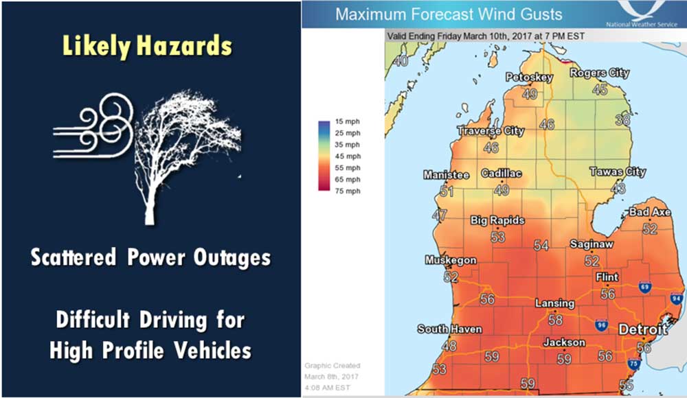
Weather Service Issues High Wind Warning
The National Weather Service has issues a High Wind Warning in effect from 7am to 7pm today, March 8th, 2017. The passage of secondary cold front today will bring unusually strong winds to the area, winds will gust to between 50 and 60 mph with the highest gusts inland from late morning into mid afternoon. Dry weather is expected into Thursday afternoon. Then a weak system passing through the area will bring a little light snow to areas near and south of I-96. This will be followed by a rather strong cold front that will give us highs below freezing Friday and Saturday. The next significant storm looks to be in the Monday time frame and the National Weather Service says a snow event with significant accumulation is possible. * The winds are expected to have the highest gusts from late morning into mid afternoon. Then the gusty winds slowly diminish through this evening. * Expect winds of 30 to 40 mph with gusts around 60 mph from late morning into mid afternoon. IMPACTS... * Impacts of the winds will be much greater than we have seen in quite some time. The lack of leaves on…