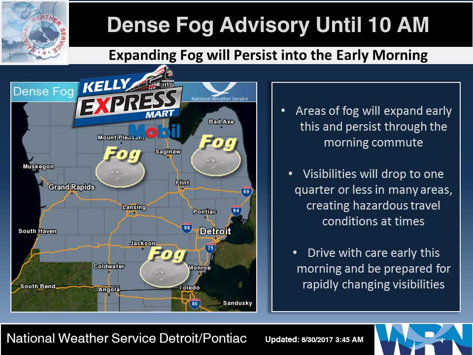
…DENSE FOG ADVISORY REMAINS IN EFFECT UNTIL 10 AM EDT THIS MORNING…
Dense fog should lift quickly by mid morning across the area. This will leave us with partly to mostly sunny skies and highs near 80 as a weak high pressure system moves through Lower Michigan today.
A Canadian cold front drops south across Lower Michigan tonight with a few light rain showers, but most areas will remain dry. The Canadian Polar air that follows the front will bring temperatures about 10 degrees cooler than they have been the past few days for Thursday and Friday. Skies should be mostly clear by mid morning Thursday and remain so into the Labor Day Weekend.
Early This Morning: Mostly cloudy. Widespread dense fog. Light winds.
Today: Mostly sunny until midday then becoming partly sunny. Widespread dense fog until midday. Highs in the lower 80s. Northwest winds 5 to 10 mph.
Tonight: Partly cloudy. Lows in the upper 50s. Northwest winds around 5 mph becoming north overnight.
Thursday: Mostly cloudy until midday then clearing. Highs in the lower 70s. Northeast winds 10 to 15 mph.
Thursday Night: Mostly clear. Lows in the mid 40s. Northeast winds around 10 mph.
Friday: Sunny. Highs in the upper 60s. East winds 10 to 15 mph with gusts to around 25 mph.
Friday Night: Mostly clear. Lows in the mid 40s.
Normal high for today is 78. The record low is 37, set in 1976. The record high is 93, set in 1969.
Yesterday’s high was 75 any 5:36 PM. The low was 58 at 11:24 PM.
0.00 inches of precipitation yesterday. Month to date: 1.61 inches.
Sunrise today at 7:01 AM EDT. Sunset at 8:15 PM EDT.