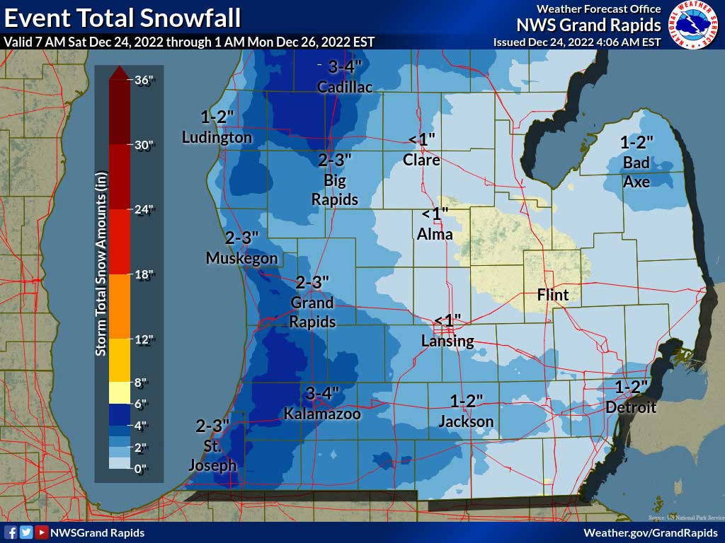
(December 24, 2022 7:34 AM) The National Weather Service has again extended the WINTER STORM WARNING, now in effect until 7 PM this evening.
* WHAT…Light snow…blowing snow and hazardous travel conditions. Additional snow accumulations of 1 to locally 4 inches. Winds gusting as high as 40 mph.
* WHERE…Eaton, Ingham, Calhoun and Jackson counties.
* WHEN…Until 7 PM EST this evening.
* IMPACTS…Plan on slippery road conditions. Widespread blowing snow will significantly reduce visibility to near zero at times. The cold wind chills as low as 25 below zero could cause frostbite on exposed skin in as little as 30 minutes.
* ADDITIONAL DETAILS…Lake effect snow will continue to push inland and affect areas in the Winter Storm Warning. While snow totals will not be heavy, hazardous travel will continue with icy roads and areas of blowing snow.
PRECAUTIONARY/PREPAREDNESS ACTIONS…
If you must travel, keep an extra flashlight, food, and water in your vehicle in case of an emergency.



East Jackson Schools Welcome Therapy Dog “Ranger”

Area HR Professionals Hosting Mixer and HR Celebration

Jackson County Emergency Leaders Observe Emergency Preparedness Month

Texas Roadhouse Hosting Jeep Ambush Show This Saturday

Boys Tennis Western vs Northwest, 9-21-26 | Photo Gallery

Cody Rowe, Jackson College Golf

Dave Rice, Insurance Circle Agency

Dr. Mohan Kulkarni, American Heart Association Annual Ball



 58°F
58°F