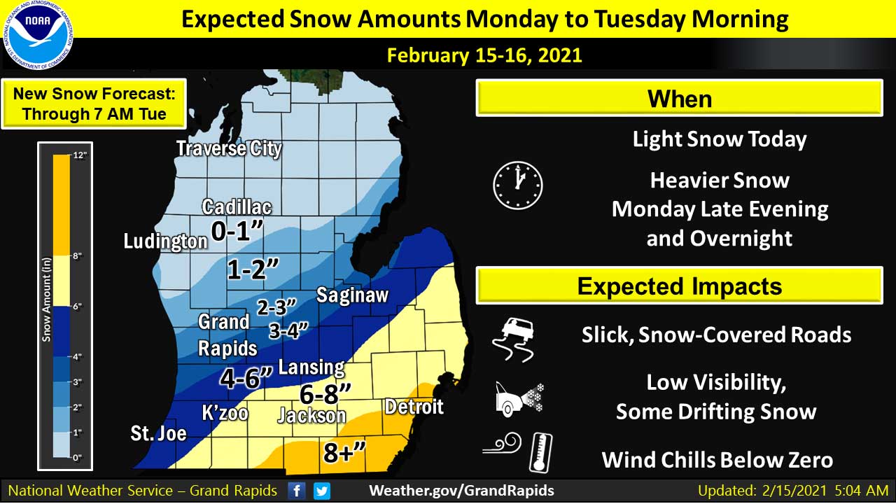
(February 15,2021 4:15 PM) The National Weather Service has issued a WINTER STORM WARNING in effect until Noon on Tuesday for Jackson and surrounding counties.
Heavy snow is expected. Additional snow accumulations of 5 to 8 inches with locally higher amounts to 10 inches possible.
Travel will be very hazardous starting this evening and lasting into Tuesday morning. Blowing snow could significantly reduce visibility and cause snow drifts on area roadways. Major impacts to the Tuesday morning commute are expected along with disruptions to normal activities potentially lasting throughout the day even after the snow ends.
Wind chills today will be near zero degrees, and wind chills tonight will be about 10 degrees below zero, increasing the potential for frostbite.
The National Weather Service says this will likely be one of the more impactful winter storm events of the winter so far. South central to southeast Michigan counties are in the warning area, along with the far southwest counties. NWS is expecting 5 to 8 inches of snow east of a line from Alma to South Haven. There will be north to northeast winds of 10 to 20 mph with gusts to 30 mph, and wind chills in the 10 to 20 below range. The snowfall rates are expected to be in the 1 to 2 inch per hour range for 4 to 5 hours during the strongest part of the storm.
The weather service urges caution. If you must travel, keep an extra flashlight, food, and water in your vehicle in case of an emergency.


Jonathan Greene: City Revises Downtown Parking Plan


Christmas Gift Ideas from Gold Crown Jewelers

Boy Scout Troop 424 Annual Christmas Tree Pickup Set for January 10


