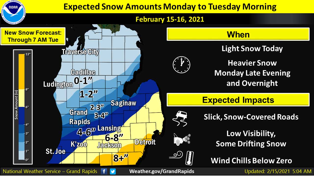
(February 15, 2021 9:58 AM) The National Weather Service has updated the WINTER WEATHER ADVISORY in effect now through 12 PM on Tuesday.
Light snow expected during the daytime hours on Monday. Heavier snow beginning this evening and continuing overnight. Temperatures will remain cold and wind chills of 0 to -10 expected. Light snow this morning will diminish by afternoon, then heavier snow arrives this evening into tonight. Additional snow accumulation of 4 to 7 inches are expected in southeastern sections of this advisory, including the areas near Kalamazoo, Battle Creek, Lansing, and Jackson.
After a break in most of the snow Monday afternoon, additional snow moves in Monday night with snow covered roads and difficult travel. Slippery travel is possible for the Monday evening commute with hazardous travel developing Monday evening into the Tuesday morning commute for many areas.
Periodic snow and very cold temperatures through Tuesday may create some travel impacts at times, especially along I-94.
Subzero wind chill temperatures are likely on Monday, Tuesday, and Wednesday mornings. A system on Thursday night could also bring accumulating snow.


Boys Basketball Concord vs Hanover Horton, 12-15-25 | Photo Gallery

Holiday Music featuring Charlie Johnson

Jackson Catholic Pastors Announce Parish Christmas Events


MDOT: Jackson County Bridge Projects Completed

Christoff & Sons Introduces New Commercial & Builder Sales Rep


