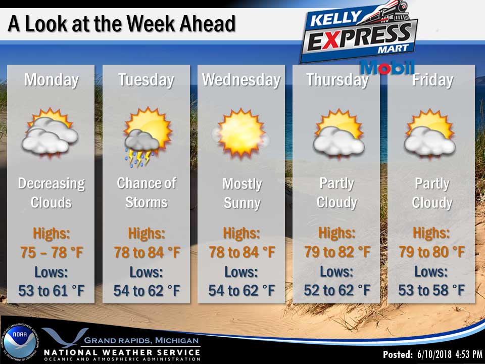
Dry and warmer weather is expected today as the stationary front which persisted over the weekend just south of Michigan sinks farther south. However considerable clouds will linger. Another frontal boundary will approach from the west on Tuesday and bring another chance of showers and storms, mainly inland from Lake Michigan. After that the remainder of the week looks predominately dry and warm.
Today
Partly sunny, with a high near 77. East wind 9 to 17 mph, with gusts as high as 26 mph.
Tonight
Partly cloudy, with a low around 61. East southeast wind 9 to 11 mph.
Tuesday
A 30 percent chance of showers and thunderstorms after 2pm. Partly sunny, with a high near 82. Southeast wind around 8 mph.
Tuesday Night
A 30 percent chance of showers and thunderstorms, mainly before 8pm. Mostly cloudy, with a low around 63. South wind around 5 mph becoming light and variable.
Wednesday
Mostly sunny, with a high near 81. Northwest wind 7 to 11 mph.
Wednesday Night
Mostly clear, with a low around 55.
Thursday
Mostly sunny, with a high near 79.
Thursday Night
A slight chance of showers and thunderstorms. Partly cloudy, with a low around 58.
Friday
Mostly sunny, with a high near 81.
Friday Night
A slight chance of showers and thunderstorms after 2am. Partly cloudy, with a low around 59.
Saturday
A slight chance of showers and thunderstorms. Partly sunny, with a high near 82.
Saturday Night
A chance of showers and thunderstorms. Mostly cloudy, with a low around 64.
Sunday
A chance of showers and thunderstorms. Mostly sunny, with a high near 87.
The high temperature yesterday was 69 at 1:04 PM, the low temperature was 60 at 6:19 AM.
The normal high for today is 78, normal low is 55.
0.01 inches of precipitation recorded yesterday. Month to date: 1.67 inches.
Sunrise today at 6:01 AM, Sunset at 9:14 PM.