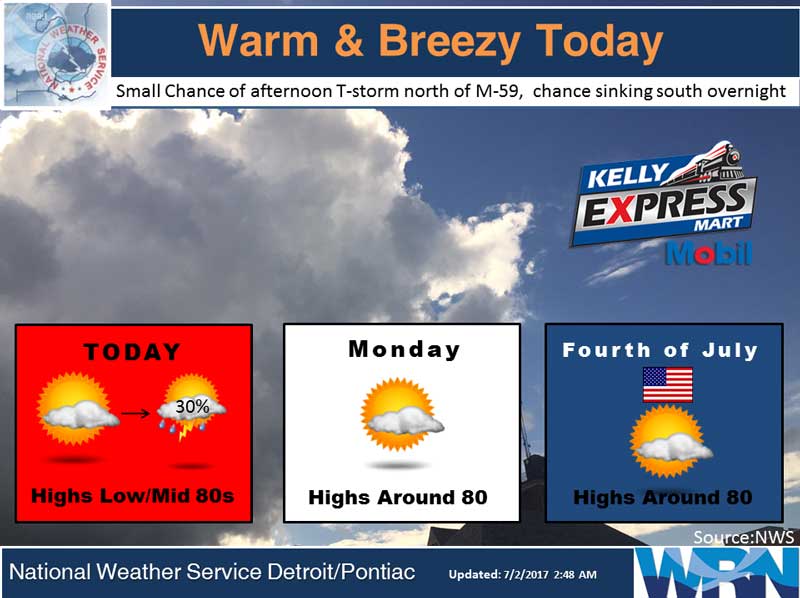
A cold front will move through this afternoon with a few showers and thunderstorms. Then high pressure will provide fair weather for much of Lower Michigan through July 4th. The chances for rain will be on the increase on Wednesday as low pressure moves in.
Today: Mostly sunny, with a high near 82. West wind 8 to 14 mph.
Tonight: A chance of showers and thunderstorms. Mostly cloudy, with a low around 61. Southwest wind 8 to 10 mph. Chance of precipitation is 30%.
Monday: A 20 percent chance of showers and thunderstorms after 2pm. Mostly sunny, with a high near 80. Calm wind becoming northeast around 6 mph in the morning.
Independence Day: Mostly sunny, with a high near 81. East southeast wind 7 to 9 mph.
Yesterday’s high temperature in Jackson was 83 at 2:44 PM. The low was 67 at 2:51 AM.
Normal high for today is 82. The record low is 43, set in 2007. The record high is 100, set in 1966.
A Trace of precipitation yesterday. Month to date rainfall: 0 inches. June Precipitation was 1.30 inches, nearly 2 inches below normal.
Sunrise today at 6:06 AM EDT. Sunset at 9:18 PM EDT.