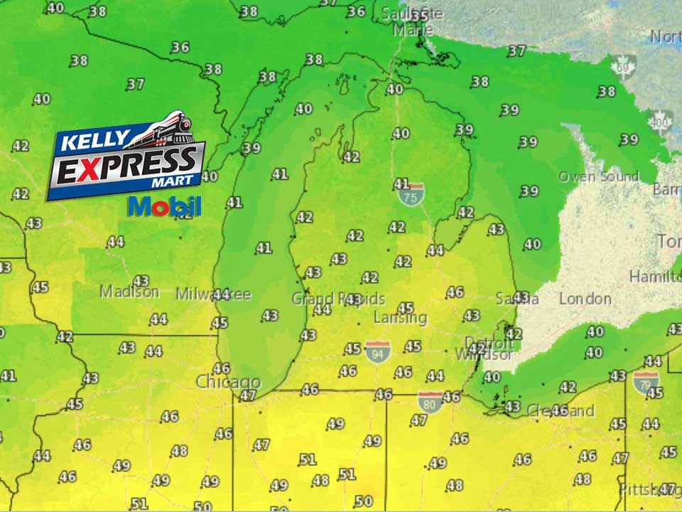
An increasing southerly flow of air will take hold today across the Great Lakes region ushering in warmer air. The warm air will result in areas of fog as higher moisture air is pushed over a melting snow pack. The fog may become dense in spots through Thursday. Today and Thursday rain showers can be expected along with temperatures that will push into the 40s today and into the lower 50s on Thursday. On the leading edge of the precipitation this morning, with some low level cold air hanging on, some light freezing rain or drizzle can be expected. By early afternoon enough warming should have taken place to change any light freezing precipitation over to all rain. A cold front will push through Lower Michigan Thursday night bringing a transition back to a period of brief freezing rain before changing over to snow. Some accumulating snow is expected late Thursday night into Friday morning.
Today
A slight chance of sleet before 7am, then a chance of freezing rain between 7am and 10am, then a chance of rain showers after 10am. Areas of fog after 7am. Otherwise, cloudy, with a high near 45. South southeast wind 10 to 14 mph. Chance of precipitation is 50%.
Tonight
A 50 percent chance of showers. Areas of fog. Otherwise, cloudy, with a temperature rising to around 49 by midnight. South wind around 17 mph.
Thursday
Showers likely, mainly after 1pm. Areas of fog. Otherwise, cloudy, with a high near 52. South wind 14 to 16 mph. Chance of precipitation is 70%. New precipitation amounts of less than a tenth of an inch possible.
Thursday Night
Rain showers before 5am, then rain, possibly mixed with snow showers. Low around 29. South wind 10 to 13 mph becoming northwest after midnight. Winds could gust as high as 21 mph. Chance of precipitation is 90%. New snow accumulation of less than a half inch possible.
Friday
Snow showers, mainly before 1pm. High near 31. North northeast wind 16 to 18 mph, with gusts as high as 28 mph. Chance of precipitation is 80%. New snow accumulation of less than one inch possible.
Friday Night
A 40 percent chance of snow showers. Mostly cloudy, with a low around 12. Blustery.
Saturday
A 30 percent chance of snow showers, mainly before 1pm. Mostly cloudy, with a high near 18. Blustery.
Saturday Night
Mostly cloudy, with a low around 3.
Sunday
Partly sunny, with a high near 17.
Average high temperature for today is 31. Average low temperature is 17.
The high temperature in Jackson yesterday was 37 at 4:23 PM, the low was 28 at 11:59 PM.
0.00 inches of precipitation yesterday. Total precipitation for the month to date: 0.05 inches.
Sunrise today at 8:06 AM EST. Sunset at 5:25 PM EST.