WIND CHILL ADVISORY REMAINS IN EFFECT UNTIL 10 AM EST THIS MORNING. Very cold wind chills expected. The cold wind chills will cause frostbite in as little as 30 minutes to exposed skin. Expect wind chills to range from 15 below zero to 25 below zero.
A Wind Chill Advisory means that cold air and the wind will combine to create low wind chills. Frost bite and hypothermia can occur if precautions are not taken. Make sure you wear a hat and gloves.
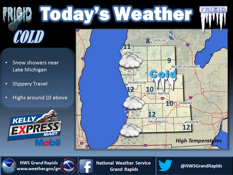
Bitterly cold arctic air will continue along with lake effect snow showers into next week. Temperatures tonight will fall below zero in most places. A clipper will bring some more widespread snow late Thursday and Friday with the heavier amounts near Lake Michigan.
Today
Sunny, with a high near 11. Wind chill values as low as -25. Northwest wind 8 to 10 mph.
Wednesday Night
Partly cloudy, with a low around -6. Calm wind.
Thursday
A 20 percent chance of snow showers after 1pm. Mostly cloudy, with a high near 13. Wind chill values as low as -10. Calm wind becoming south 5 to 9 mph in the morning.
Thursday Night
A 40 percent chance of snow showers. Cloudy, with a low around 5. South wind around 9 mph.
Friday
A 20 percent chance of snow showers. Mostly cloudy, with a high near 18.
Friday Night
A 30 percent chance of snow showers. Mostly cloudy, with a low around 8.
Saturday
Mostly cloudy, with a high near 14.
Saturday Night
Partly cloudy, with a low around -1.
Sunday
Partly sunny and cold, with a high near 10.
Sunday Night
Mostly cloudy, with a low around 0.
New Year’s Day
Partly sunny, with a high near 11.
Average high temperature for today is 32. Average low temperature is 19.
The high temperature in Jackson yesterday was 13 at 1:40 PM, the low was 0 at 10:27 PM.
0.01 inches of precipitation yesterday. Total precipitation for the month to date: 0.66 inches.
Sunrise today at 8:06 AM EST. Sunset at 5:12 PM EST.