Wind Chill Advisory and Light Snow Expected
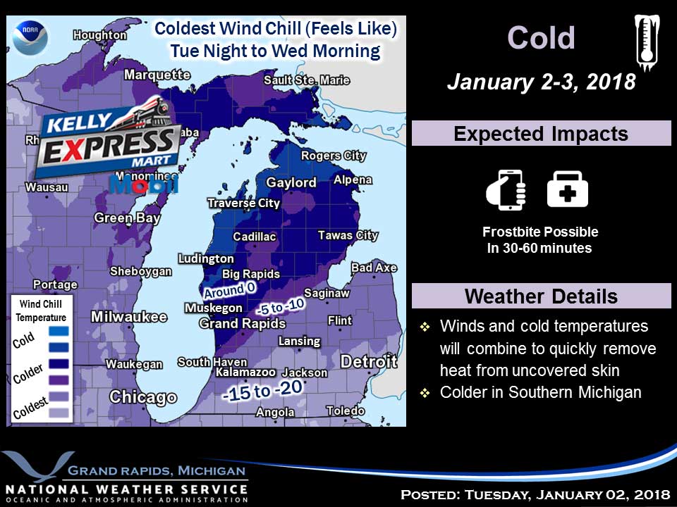
WIND CHILL ADVISORY REMAINS IN EFFECT UNTIL 10 AM EST THIS MORNING. Very cold wind chills expected. The cold wind chills will cause frostbite in as little as 30 minutes to exposed skin. Expect wind chills to range from 10 below zero to 20 below zero. Expect light snow today as a cold front trailing a surface low currently over eastern Lake Superior comes through the area this morning. The snow associated with this system will come to an end by this evening. Expect an inch or two. Tonight our clipper low merges with a very powerful Nor-Easter and that will result in two days of north winds and arctic air. Beyond that a southern stream system tries to move into the area late in the weekend or by early next week. That will bring an end to this unusually cold weather but may mean a snow storm. That will have to be watched. Today Snow showers, mainly after 9am. High near 15. Wind chill values as low as -13. Southwest wind 11 to 13 mph. Chance of precipitation is 80%. New snow accumulation of less than a half inch possible. Wednesday Night A 30 percent chance of snow showers…