Quantcast
Skip to content

Continued Sunny and Warm

High pressure will provide one more day of fair weather before moving east on Thursday. A cold front will bring the chance of strong to severe thunderstorms on Thursday afternoon and evening.  Then the rains should move east by Friday afternoon with fair weather for the weekend. Today:  Sunny. Highs in the lower 80s. East winds 5 to 10 mph until midday becoming light. Tonight:  Partly cloudy. Lows in the lower 60s. Light winds. Thursday:  Mostly sunny. Highs in the mid 80s. West winds 5 to 10 mph. Yesterday’s high temperature in Jackson was 84 at 3:58 PM.  The low was 58 at 5:42 AM. Normal high for today is 82.  The record low is 43, set in 1972.  The record high is 97, set in 1988. 0.0 inches of precipitation yesterday.  Month to date rainfall:  0.54 inches.    Sunrise today at 6:09 AM EDT.  Sunset at 9:17 PM EDT.

Read more

A Sparkling Fourth

High pressure will provide fair weather through Wednesday. A cold front may bring showers and thunderstorms on Thursday   into Friday. Today:  Sunny, with a high near 81. East wind 7 to 9 mph. Tonight:  Mostly clear, with a low around 58. East wind 3 to 5 mph. Wednesday:  Sunny, with a high near 84. Calm wind becoming east southeast 5 to 8 mph in the morning. Yesterday’s high temperature in Jackson was 80 at 6:12 PM.  The low was 62 at 5:50 AM. Normal high for today is 82.  The record low is 44, set in 1968.  The record high is 96, set in 1990. .50 inches of precipitation yesterday.  Month to date rainfall:  0.54 inches.    Sunrise today at 6:07 AM EDT.  Sunset at 9:17 PM EDT.

Read more

Mostly Sunny and Warmer

High pressure will bring fair weather through the Fourth of July. There is chance of showers and thunderstorms for Wednesday as low pressure tracks towards Lower Michigan. Today:  Partly sunny until midday then becoming mostly sunny. Highs in the upper 70s. Northeast winds 5 to 10 mph. Tonight:  Partly cloudy. Lows in the upper 50s. East winds 5 to 10 mph. Independence Day:  Sunny. Highs around 80. East winds 5 to 10 mph. Yesterday’s high temperature in Jackson was 84 at 3:32 PM.  The low was 60 at 5:36 AM. Normal high for today is 82.  The record low is 44, set in 1988.  The record high is 101, set in 1966. .04 inches of precipitation yesterday.  Month to date rainfall:  0.04 inches.    Sunrise today at 6:06 AM EDT.  Sunset at 9:18 PM EDT.

Read more

Sunny and Breezy

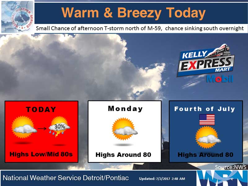
A cold front will move through this afternoon with a few showers and thunderstorms. Then high pressure will provide fair weather for much of Lower Michigan through July 4th. The chances for rain will be on the increase on Wednesday as low pressure moves in. Today:  Mostly sunny, with a high near 82. West wind 8 to 14 mph. Tonight:  A chance of showers and thunderstorms. Mostly cloudy, with a low around 61. Southwest wind 8 to 10 mph. Chance of precipitation is 30%. Monday:  A 20 percent chance of showers and thunderstorms after 2pm. Mostly sunny, with a high near 80. Calm wind becoming northeast around 6 mph in the morning. Independence Day:  Mostly sunny, with a high near 81. East southeast wind 7 to 9 mph. Yesterday’s high temperature in Jackson was 83 at 2:44 PM.  The low was 67 at 2:51 AM. Normal high for today is 82.  The record low is 43, set in 2007.  The record high is 100, set in 1966. A Trace of precipitation yesterday.  Month to date rainfall:  0 inches.  June Precipitation was 1.30 inches, nearly 2 inches below normal. Sunrise today at 6:06 AM EDT.  Sunset at 9:18 PM EDT.

Read more

Mostly Sunny Weekend

Low pressure will move east today with only a few lingering showers through this afternoon. A cold front will touch off a few showers and isolated thunderstorms on Sunday then high pressure will build in with fair weather through Tuesday. Today:  Partly sunny until midday then becoming mostly sunny. A 20 percent chance of showers and thunderstorms. Highs around 80. West winds 10 to 15 mph with gusts to around 25 mph. Tonight:  Partly cloudy. Lows around 60. Southwest winds around 10 mph. Sunday:  Mostly sunny. A 20 percent chance of showers in the afternoon. Highs in the lower 80s. West winds 10 to 15 mph with gusts to around 25 mph. Yesterday’s high temperature in Jackson was 83 at 12:10 PM.  The low was 67 at 11:59 PM. Normal high for today is 82.  The record low is 40, set in 1988.  The record high is 95, set in 1963. .38 inches of precipitation yesterday.  Month to date rainfall:  1.30 inches. Sunrise today at 6:05 AM EDT.  Sunset at 9:18 PM EDT.

Read more

Scattered Showers

Scattered showers and thunderstorms will continue to impact the region through the weekend, but the overall coverage should decrease each day as drier air gradually filters in from the northwest. Temperatures will be near to above normal through the Fourth of July holiday. Today: Showers likely before 8am, then a chance of showers and thunderstorms after 2pm. Mostly cloudy, with a high near 83. Southwest wind 7 to 9 mph. Chance of precipitation is 60%. New rainfall amounts between a tenth and quarter of an inch, except higher amounts possible in thunderstorms. Tonight:  A 50 percent chance of showers and thunderstorms. Mostly cloudy, with a low around 67. South southwest wind around 8 mph. Saturday:  A 30 percent chance of showers and thunderstorms, mainly before 2pm. Mostly cloudy, with a high near 80. West wind 8 to 13 mph. Yesterday’s high temperature in Jackson was 87 at 3:42 PM.  The low was 65 at 4:34 AM. Normal high for today is 82.  The record low is , set in 1989.  The record high is 95, set in 1964. A trace of precipitation yesterday.  Month to date rainfall:  0.92 inches. Sunrise today at 6:04 AM EDT.  Sunset at 9:18 PM EDT.

Read more

Warmer with Periods of Showers

A meandering frontal boundary will remain draped across the Great Lakes Region through Friday night. Warm and humid air interacting with this front will bring periods of showers and thunderstorms, with a risk of locally heavy rainfall and possibly a few strong or severe storms. Today: A 30 percent chance of showers and thunderstorms, mainly after 3pm. Mostly cloudy, with a high near 84. Southwest wind 16 to 18 mph, with gusts as high as 30 mph. Tonight:  Showers and thunderstorms likely, mainly after 11pm. Mostly cloudy, with a low around 70. Southwest wind 10 to 14 mph. Chance of precipitation is 60%. New rainfall amounts between a tenth and quarter of an inch, except higher amounts possible in thunderstorms. Friday:  Showers and thunderstorms likely. Mostly cloudy, with a high near 80. Southwest wind 10 to 13 mph, with gusts as high as 21 mph. Chance of precipitation is 70%. New rainfall amounts between a quarter and half of an inch possible. Yesterday’s high temperature in Jackson was 78 at 1:57 PM.  The low was 50 at 5:32 AM. Normal high for today is 82.  The record low is 43, set in 1989.  The record high is 95, set in…

Read more

Warmer with Possible Showers

Periodic showers and thunderstorms are expected today through Friday as an active frontal boundary and warmer and more humid air impacts the area. Today:  Mostly sunny until midday, then mostly cloudy with a 20 percent chance of rain showers in the afternoon. Highs in the mid 70s. South winds 10 to 15 mph with gusts to around 25 mph. Tonight:  Mostly cloudy. A chance of showers and a slight chance of thunderstorms overnight. Lows in the mid 60s. South winds 10 to 15 mph with gusts to around 30 mph. Thursday:  Mostly cloudy with a 50 percent chance of showers and thunderstorms. Highs in the lower 80s. Southwest winds 15 to 20 mph with gusts to around 30 mph. Yesterday’s high temperature in Jackson was 74 at 4:15 PM.  The low was 48 at 5:42 AM. Normal high for today is 82.  The record low is 43, set in 1992.  The record high is 101, set in 1971. No precipitation yesterday.  Month to date rainfall:  0.92 inches. Sunrise today at 6:04 AM EDT.  Sunset at 9:18 PM EDT.

Read more

Sunny and Cooler than Normal

High pressure will provide plenty of sunshine today although temperatures will remain below normal. It will not be as windy as yesterday.  On Wednesday and Wednesday night a warm front will push in from the southwest, resulting in showers and thunderstorms.  The main thunderstorm risk on Thursday is expected to be south of Michigan, but that risk will expand north again on Friday and Friday night. Today:  Sunny until midday then becoming partly sunny. A 20 percent chance of rain showers. Highs in the lower 70s. West winds 5 to 15 mph. Tonight:  Mostly clear. Lows in the lower 50s. West winds 5 to 10 mph becoming southwest overnight. Wednesday:  Sunny until midday then becoming partly sunny. Highs in the upper 70s. South winds 5 to 15 mph with gusts to around 25 mph. Yesterday’s high temperature in Jackson was 70 at 3:17 PM.  The low was 51 at 11:59 PM. Normal high for today is 82.  The record low is 44, set in 1988.  The record high is 101, set in 1971. A trace of precipitation yesterday.  Month to date rainfall:  0.92 inches. Sunrise today at 6:03 AM EDT.  Sunset at 9:18 PM EDT.

Read more

Cooler with Chance of Showers

Another unseasonably chilly day is in store with highs only in the 60s and scattered rain showers. Temperatures will gradually moderate after today, returning to closer to normal by mid to late week. However the return of the warmer air will also result in showers and thunderstorms with a risk of some stronger storms and locally heavy rain. Today:  Mostly sunny with a slight chance of rain showers until midday, then partly sunny with a chance of rain showers and a slight chance of thunderstorms in the afternoon. Highs in the upper 60s. West winds 10 to 20 mph. Chance of rain 30 percent. Tonight:  Partly cloudy. A 20 percent chance of rain showers in the evening. Lows in the upper 40s. West winds 5 to 15 mph. Tuesday:  Mostly sunny. Highs in the lower 70s. West winds 5 to 10 mph. Yesterday’s high temperature in Jackson was 71 at 3:03 PM.  The low was 52 at 11:27 PM. Normal high for today is 81.  The record low is 37, set in 1979.  The record high is 100, set in 1988. .02 inches of precipitation yesterday.  Month to date rainfall:  0.92 inches. Sunrise today at 6:03 AM EDT.  Sunset at…

Read more

Contact Us

152 West Michigan Avenue
Jackson, MI 49201
517-787-8817
viewermail@jtv.tv

Back To Top