Quantcast
Skip to content

Cooler and Mainly Dry Weather

Cooler and mainly dry weather can be expected through midweek as Canadian high pressure builds south into the western Great Lakes Region. Breezy conditions can be expected today and Tuesday due to a low pressure system over the eastern Great Lakes. Temperatures will moderate a bit toward the end of the week. Today:   A 20 percent chance of showers after 3pm. Partly sunny, with a high near 72. North wind 5 to 11 mph, with gusts as high as 21 mph. Tonight:  A 20 percent chance of showers before 9pm. Partly cloudy, with a low around 51. North wind 6 to 13 mph, with gusts as high as 21 mph. Tuesday:  A 20 percent chance of showers after 3pm. Partly sunny, with a high near 68. North wind 7 to 13 mph, with gusts as high as 22 mph. Yesterday’s high temperature in Jackson was 85 at 4:45 PM.  The low was 67 at 11:59 PM. Normal high for today is 76.  The record low is 36, set in 1990.  The record high is 92, set in 1977. A trace of precipitation yesterday.  Month to date rainfall:  0.41 inches. Sunrise today at 6:02 AM EDT.  Sunset at 9:12 PM…
Read more

Showers Ending, Becoming Partly Sunny

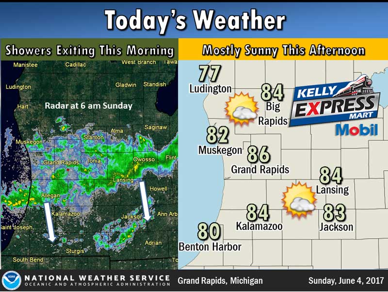
Decreasing cloudiness will occur today after scattered showers and thunderstorms end later this morning. It will be quite warm with highs in the mid 80s inland from Lake Michigan. A cold front will move south through the state tonight and usher in a much cooler air mass for Monday and Tuesday. Today: A 30 percent chance of showers and thunderstorms, mainly before 2pm. Partly sunny, with a high near 83. West wind 11 to 15 mph, with gusts as high as 25 mph. Tonight:  A 10 percent chance of showers and thunderstorms before 8pm. Partly cloudy, with a low around 59. West wind 6 to 8 mph. Monday:  Mostly sunny, with a high near 72. North wind 6 to 11 mph. Yesterday’s high temperature in Jackson was 83 at 3:05 PM.  The low was 51 at 3:25 AM. Normal high for today is 75.  The record low is 34, set in 1988.  The record high is 101, set in 1971. No precipitation yesterday.  Month to date rainfall:  4.21 inches. Sunrise today at 6:03 AM EDT.  Sunset at 9:10 PM EDT.

Read more

Summerlike Weekend

A very summerlike weekend is in store with highs in the 80s. A few showers and thunderstorms are possible but the majority of the weekend will be dry. Cooler weather is anticipated for the first part of next week.  Low pressure passing by to our north will push a warm  front through the area tonight, then will drag a cold front south through the state on Sunday night. Today: Mostly sunny, with a high near 84. Calm wind becoming south 5 to 7 mph in the afternoon. Tonight:  A 50 percent chance of showers and thunderstorms after 3am. Mostly cloudy, with a low around 63. South southwest wind 5 to 8 mph. Sunday:  A 50 percent chance of showers and thunderstorms. Partly sunny, with a high near 84. West southwest wind 8 to 13 mph, with gusts as high as 23 mph. Yesterday’s high temperature in Jackson was 80 at 4:38 PM.  The low was 46 at 4:32 AM. Normal high for today is 75.  The record low is 37, set in 1977.  The record high is 90, set in 1963. No precipitation yesterday.  Month to date rainfall:  4.21 inches. Sunrise today at 6:03 AM EDT.  Sunset at 9:10 PM…

Read more

Sunshine and Warm Temperatures

High pressure will provide another pleasant day before slipping away Saturday. Low pressure tracking east across the northern Great Lakes Region over the weekend will bring scattered showers and thunderstorms. Today:  Sunny, with a high near 78. Light west wind increasing to 5 to 9 mph in the morning. Tonight:  Mostly clear, with a low around 53. West northwest wind around 6 mph becoming calm in the evening. Saturday:  A 30 percent chance of showers and thunderstorms after 2pm. Mostly sunny, with a high near 80. Calm wind becoming southwest 5 to 7 mph in the afternoon. Sunday:  A 30 percent chance of showers and thunderstorms. Partly sunny, with a high near 80. West wind 8 to 13 mph, with gusts as high as 24 mph. Yesterday’s high temperature in Jackson was 74 at 4:45 PM.  The low was 48 at 5:40 PM. Normal high for today is 75.  The record low is 34, set in 1988.  The record high is 101, set in 1971. No precipitation yesterday.  Month to date rainfall:  4.21 inches. Sunrise today at 6:03 AM EDT.  Sunset at 9:09 PM EDT.

Read more

Sunny and Pleasant

High pressure will provide pleasant weather today and tomorrow with sunshine, highs in the 70s, and low humidity. Low pressure and a warm front will bring periods of showers and thunderstorms over the weekend. Today:   Sunny, with a high near 74. West northwest wind 5 to 10 mph, with gusts as high as 18 mph. Tonight:  Mostly clear, with a low around 49. West northwest wind 3 to 8 mph. Friday:  Sunny, with a high near 77. Light west wind increasing to 5 to 9 mph in the morning. Saturday:  A 30 percent chance of showers and thunderstorms, mainly after 2pm. Partly sunny, with a high near 78. Yesterday’s high temperature in Jackson was 70 at 2:19 PM.  The low was 51 at 11:59 PM. Normal high for today is 74.  The record low is 34, set in 1966.  The record high is 90, set in 1978. Highest wind speed yesterday was 24, with highest gust at 31. A trace of precipitation yesterday.  Month to date rainfall:  4.21 inches. Sunrise today at 6:04 AM EDT.  Sunset at 9:08 PM EDT.

Read more

Staying Dry

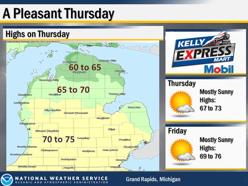
Mainly dry weather is expected from today through Friday across the area. An isolated shower is possible this afternoon, but most areas will remain dry. High pressure will be in control of our weather tonight into Thursday night and will be responsible for the dry conditions. Friday a warm front will be developing to our southwest with better chances for showers and storms as we head into Saturday. After below normal temperatures today, with highs in the 60s, we will return to the 70s for Thursday and Friday. Today:  Partly sunny. Isolated rain showers in the afternoon. Highs around 70. West winds 10 to 20 mph with gusts to around 30 mph. Chance of rain 20 percent. Tonight:  Mostly clear. Lows in the upper 40s. West winds 5 to 10 mph. Gusts up to 20 mph in the evening. Thursday:  Sunny. Highs in the lower 70s. West winds 5 to 15 mph. Yesterday’s high temperature in Jackson was 72 at 2:16 PM.  The low was 48 at 5:43 AM. Normal high for today is 74.  The record low is 32, set in 1966.  The record high is 94, set in 1977. Highest wind speed yesterday was 25, with highest gust…

Read more

Cooler Temperatures and More Clouds

We will see more in the way of cloud cover today and Wednesday as we remain under the influence of an upper low in the northern Great Lakes. It will be cooler with highs mainly in the 60s today and Wednesday as well. A few showers and possibly an isolated thunderstorms can be expected this afternoon and evening. A dry period is expected from Wednesday evening into Thursday evening with high pressure located nearby. Showers and thunderstorms return to the forecast for Thursday night into Friday with a warm front lifting into the area. High temperatures warm back into the 70s for the end of the work week. Today:  A slight chance of showers between 2pm and 5pm, then a slight chance of showers and thunderstorms after 5pm. Mostly sunny, with a high near 72. West wind 7 to 17 mph, with gusts as high as 28 mph. Chance of precipitation is 20%. Tonight:  A slight chance of showers and thunderstorms before 8pm, then a slight chance of showers between 8pm and 2am. Mostly cloudy, with a low around 50. West southwest wind 7 to 11 mph. Chance of precipitation is 20%. Wednesday:  A slight chance of showers between 8am…

Read more

Scattered Showers

We will see another day with highs in the 70s on Memorial Day with some scattered showers and isolated thunderstorms this afternoon and evening. Coverage on the precipitation will not be widespread. An upper low located over the northern Great Lakes will bring a fair amount of cloud cover for Tuesday into Wednesday with isolated to scattered showers at times both days. Highs on Tuesday and Wednesday will cool into the 60s, which is below normal for this time of year. Today:  Isolated showers between 11am and 2pm, then scattered showers and thunderstorms after 2pm. Mostly sunny, with a high near 76. West southwest wind 8 to 17 mph, with gusts as high as 26 mph. Chance of precipitation is 30%. Tonight:  Scattered showers and thunderstorms, mainly before 8pm. Partly cloudy, with a low around 52. West southwest wind 7 to 10 mph. Chance of precipitation is 30%. Tuesday:  A 30 percent chance of showers after 2pm. Mostly sunny, with a high near 69. West wind 10 to 17 mph, with gusts as high as 28 mph. Yesterday’s high temperature in Jackson was 78 at 1:37 PM.  The low was 56 at 5:24 AM. Normal high for today is 73. …

Read more

Showers and Thunderstorms Likely

Showers and thunderstorms are likely this afternoon and evening.  A few storms may reach severe levels with large hail and damaging winds.   The region will become more influenced by an upper low over the next couple of days with a fair amount of cloudiness and chances for showers especially during the afternoon and evening hours of Memorial Day and Tuesday. Today:  A slight chance of showers, then showers and thunderstorms likely after noon. Mostly cloudy, with a high near 76. Southeast wind 7 to 9 mph. Chance of precipitation is 60%. New rainfall amounts between a tenth and quarter of an inch, except higher amounts possible in thunderstorms. Tonight:  Showers and thunderstorms likely before midnight, then a slight chance of showers between midnight and 3am. Mostly cloudy, with a low around 55. West wind 8 to 13 mph. Chance of precipitation is 70%. New precipitation amounts between a tenth and quarter of an inch, except higher amounts possible in thunderstorms. Memorial Day:  A 20 percent chance of showers and thunderstorms after 3pm. Mostly sunny, with a high near 73. West southwest wind 9 to 18 mph, with gusts as high as 28 mph. Yesterday’s high temperature in Jackson was…

Read more

Partly Sunny and Warm

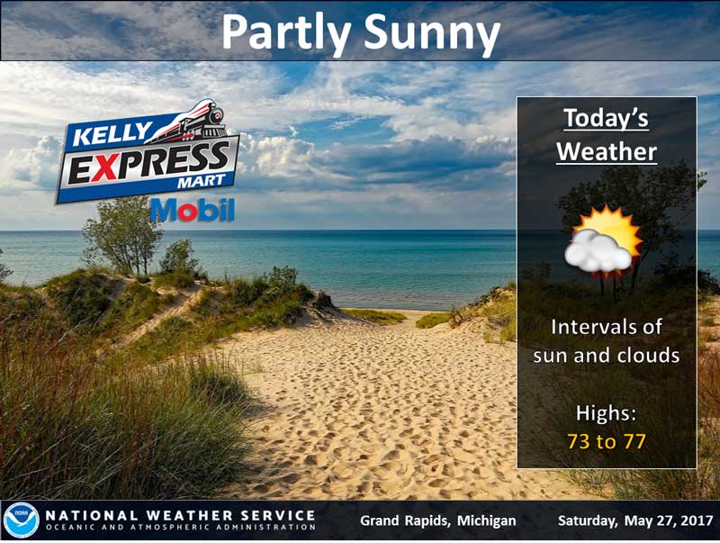
An area of low pressure will move from Central Illinois tonight through southern portions of the Lower Peninsula on Sunday. Today and Tonight will be fairly dry with increasing chances for precipitation on Sunday. Showers and thunderstorms will accompany the passage of the low on Sunday. Some of the storms could be on the strong side on Sunday. Rain showers remain in the forecast for Memorial Day as an upper low moves toward the region. Not a wash out of a Holiday weekend, but we will see some rain. The driest day will likely be today with the wettest occurring on Sunday. Highs will be near normal for this time of year. Today:  Partly sunny, with a high near 75. East southeast wind 5 to 7 mph. Tonight:  Mostly cloudy, with a low around 56. South southeast wind around 6 mph. Sunday:  Showers and thunderstorms likely, mainly after 3pm. Mostly cloudy, with a high near 74. Southeast wind 8 to 11 mph, with gusts as high as 20 mph. Chance of precipitation is 70%. New rainfall amounts between a tenth and quarter of an inch, except higher amounts possible in thunderstorms. Memorial Day:  A 20 percent chance of showers and…

Read more

Contact Us

152 West Michigan Avenue
Jackson, MI 49201
517-787-8817
viewermail@jtv.tv

Back To Top